Saas-Fee / Saastal Tourism
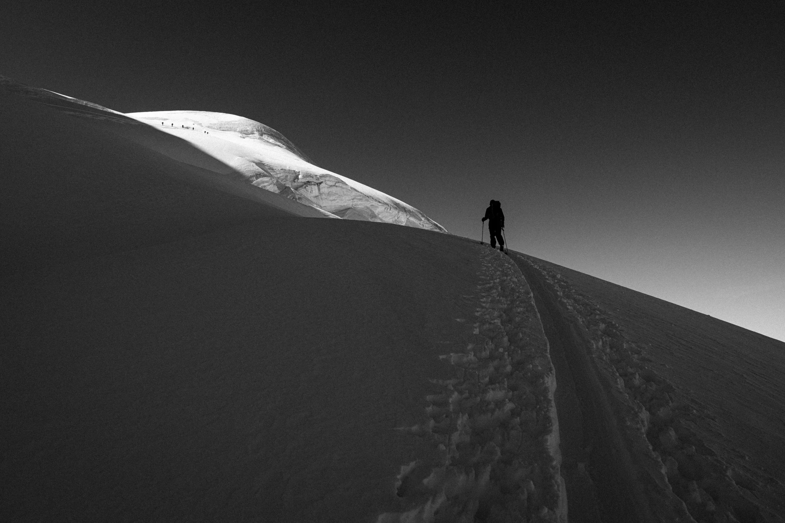
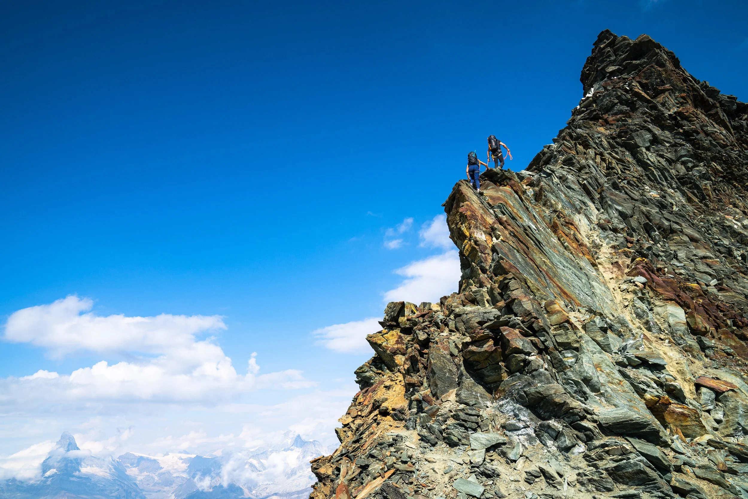
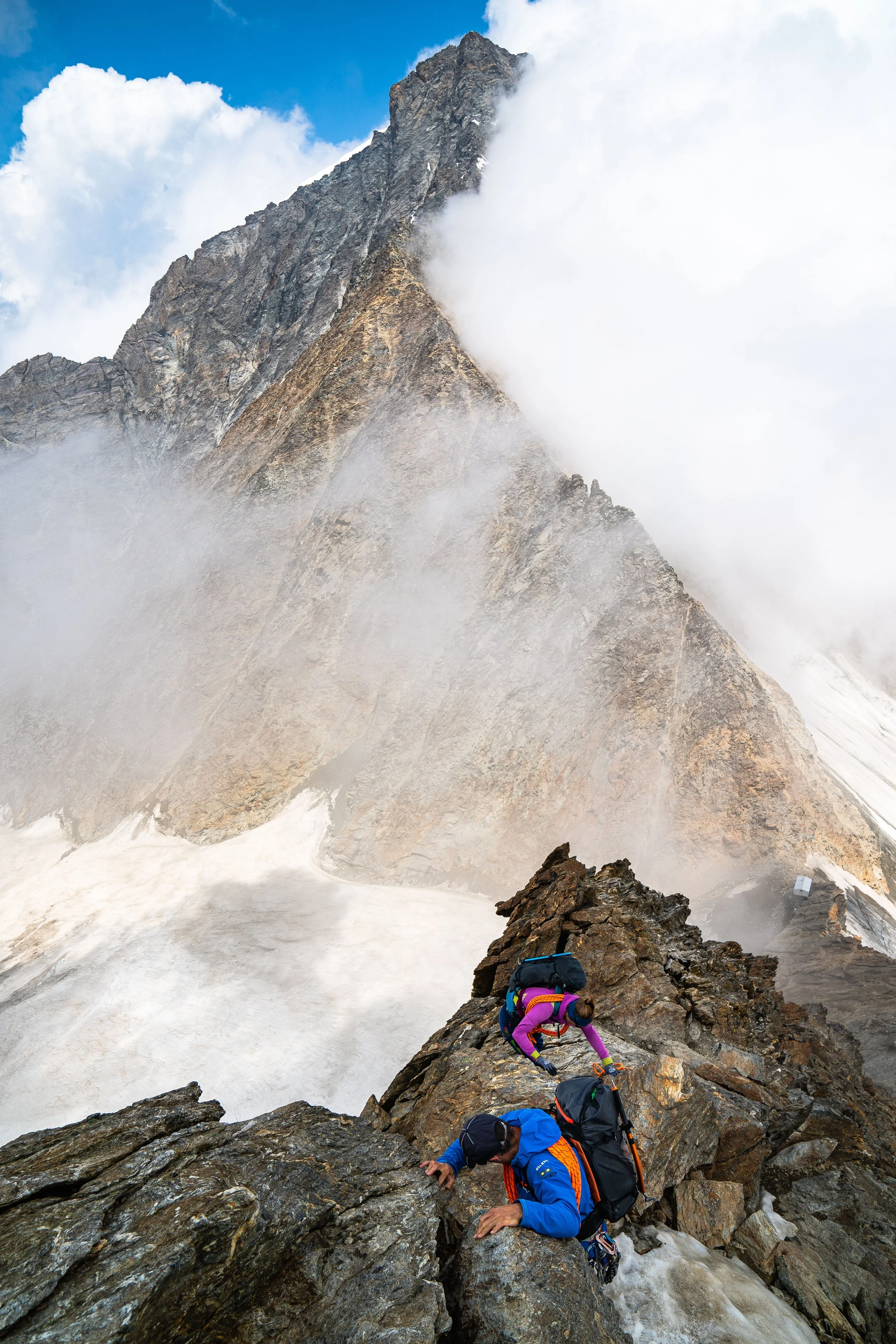
The Portjengrat and Dri Horlini Traverse


Saas-Fee / Saastal Tourism
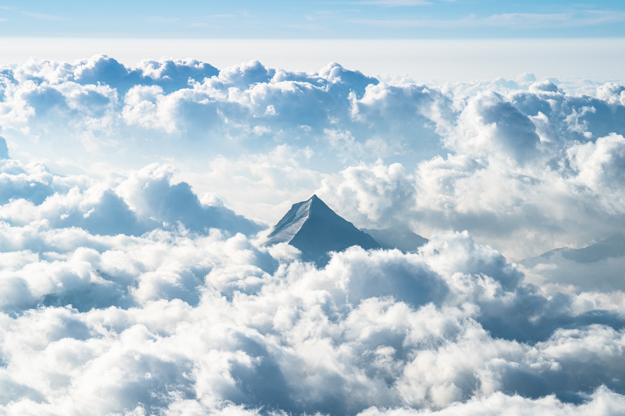
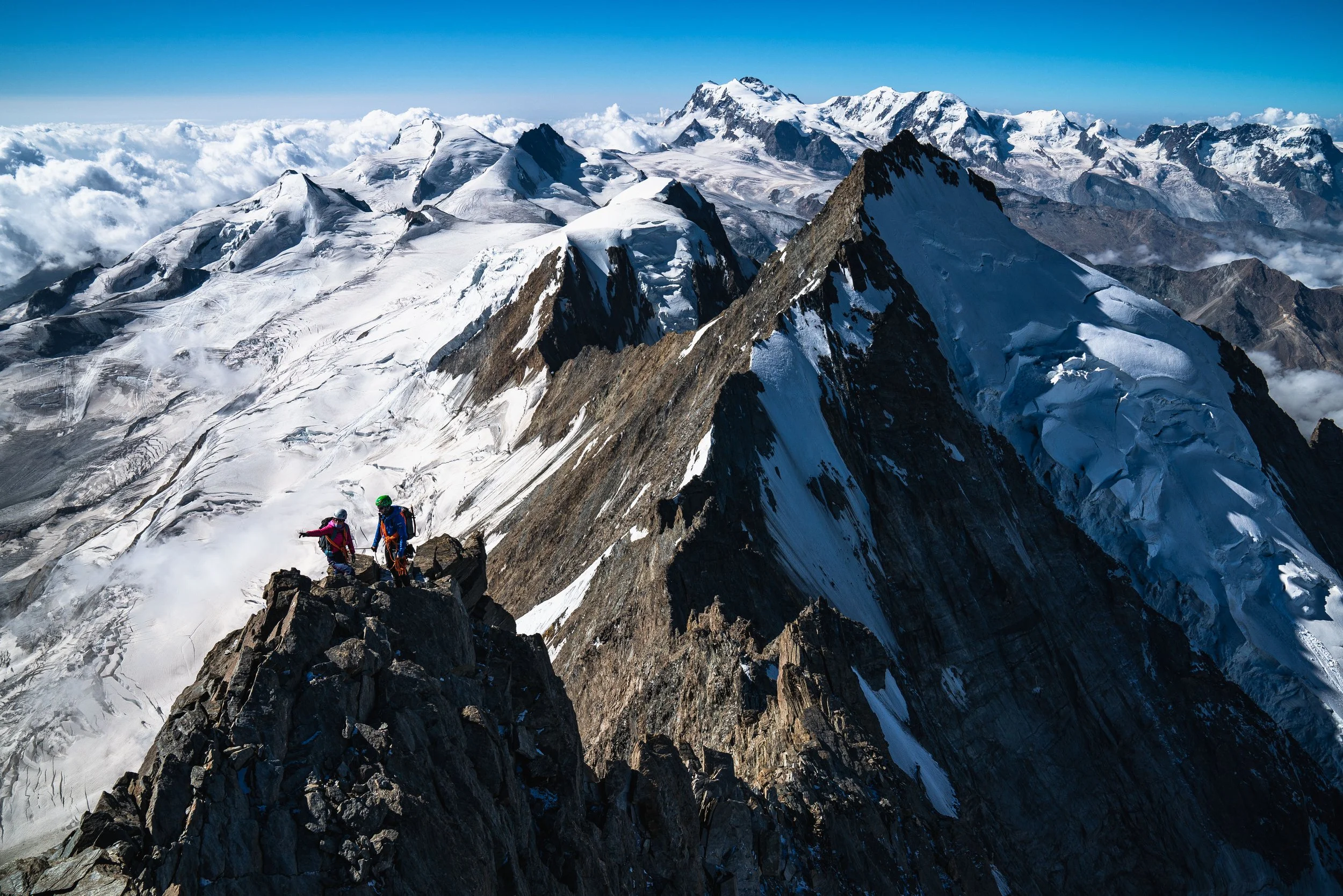
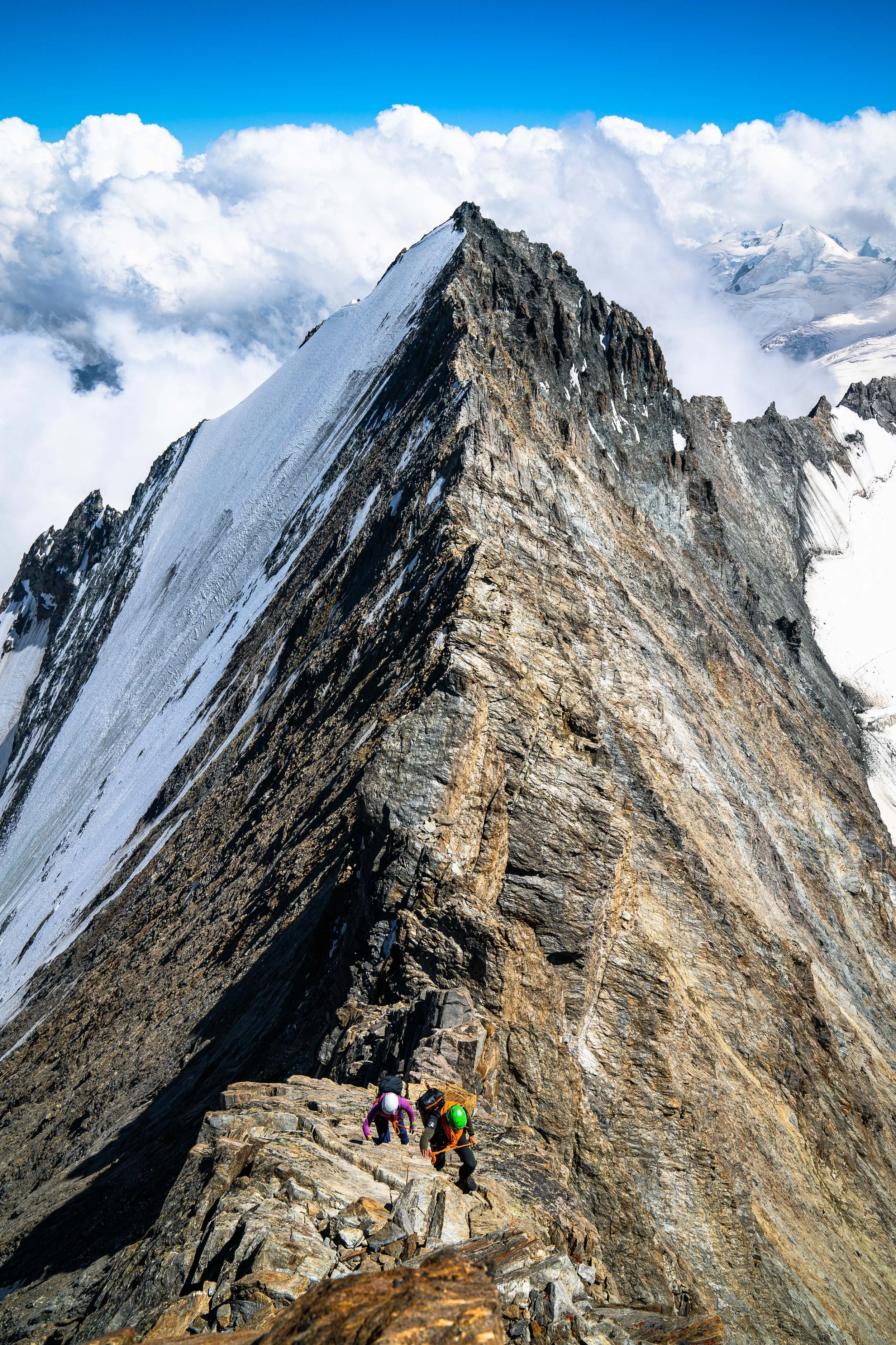
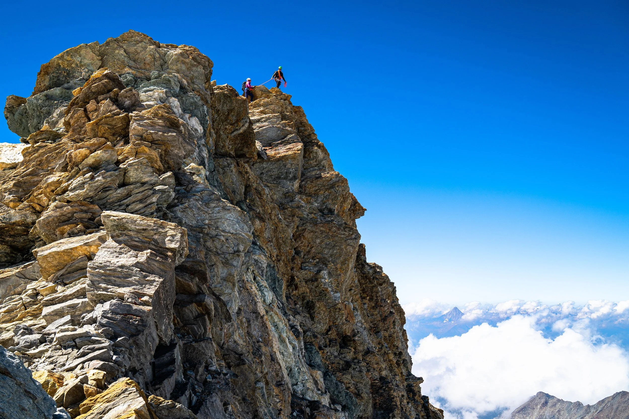
The Mischabel Traverse, a two day expedition traversing 5 different 4,000 meter peaks over 2 days. Take a virtual tour from your sofa of new mountain perspectives.


Saas-Fee / Saastal Tourism
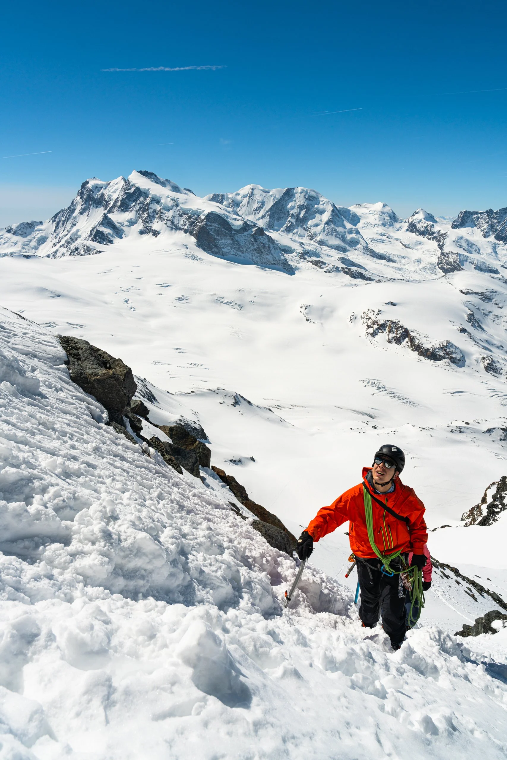
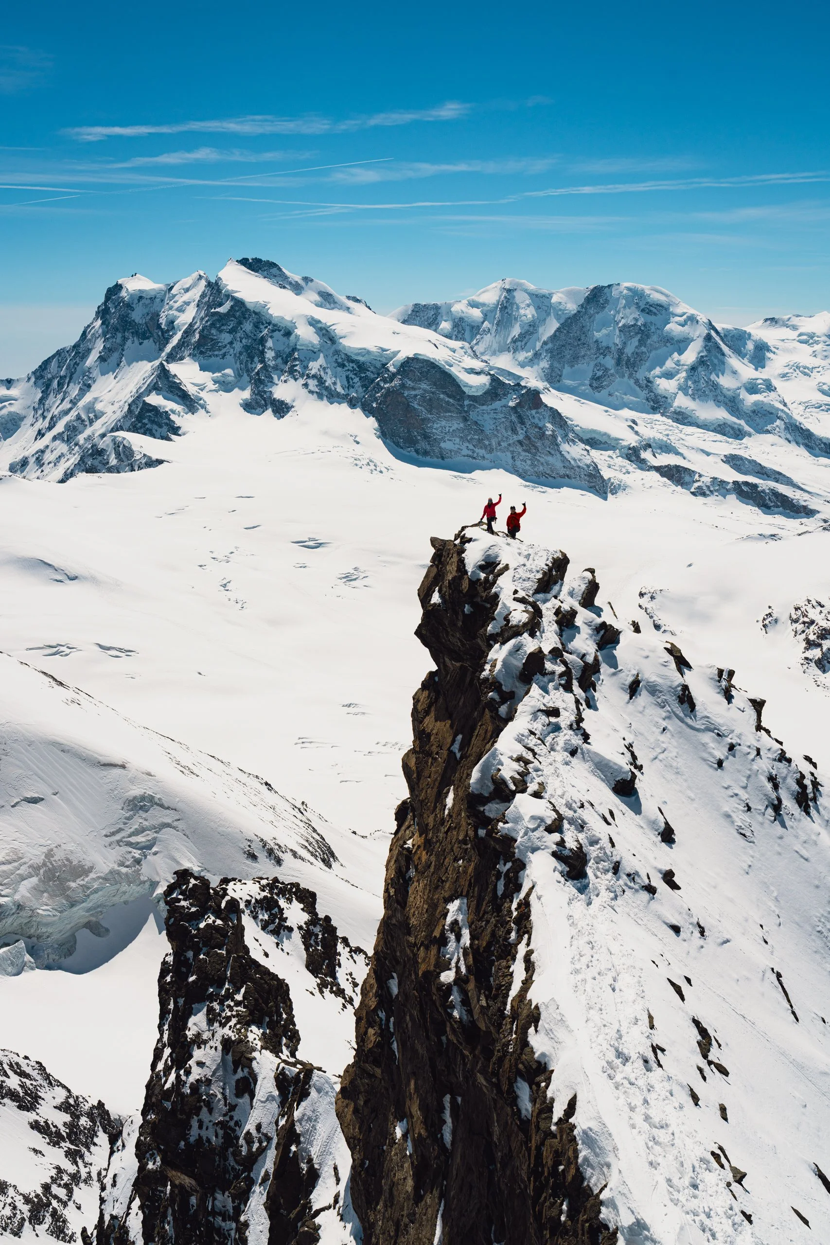
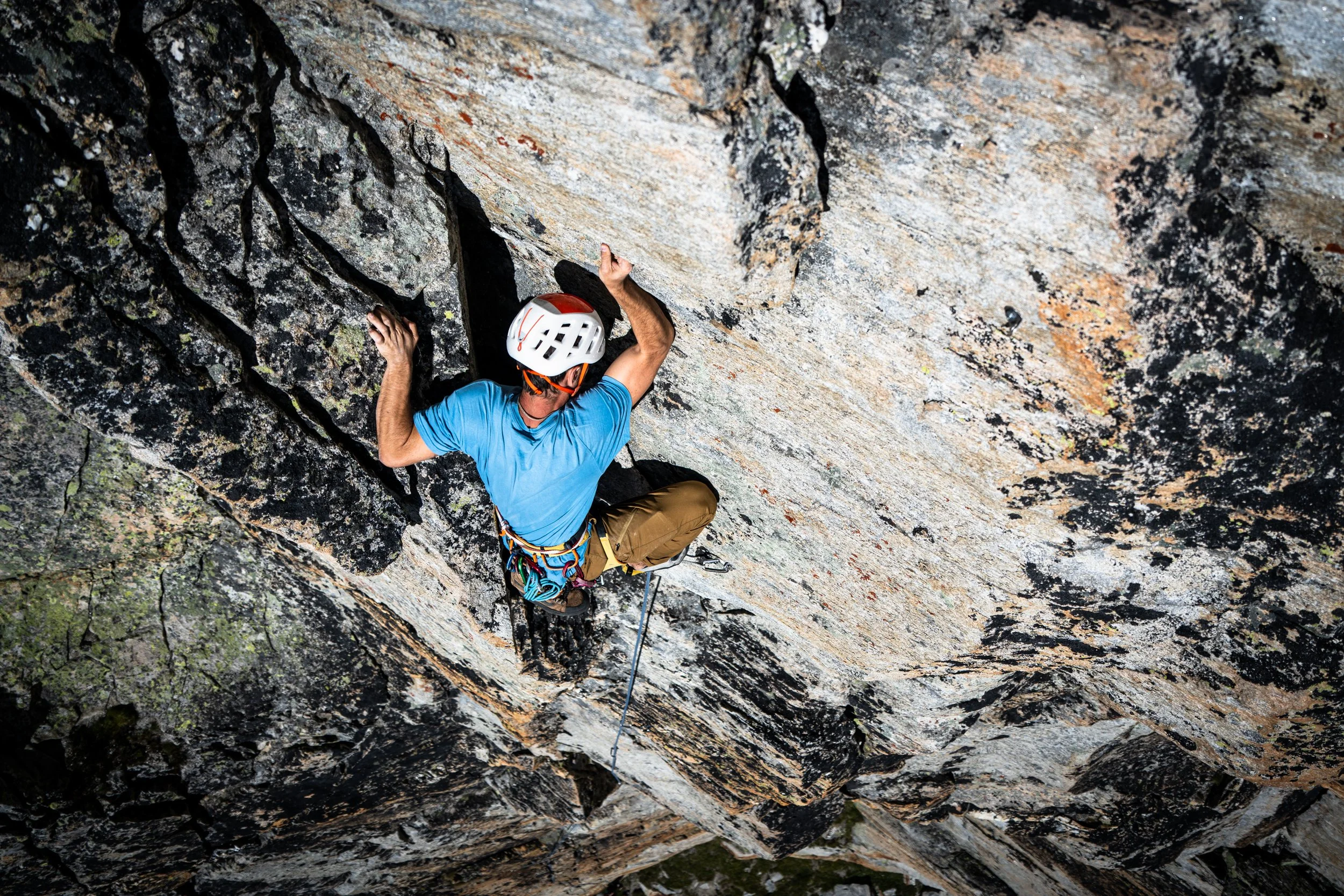
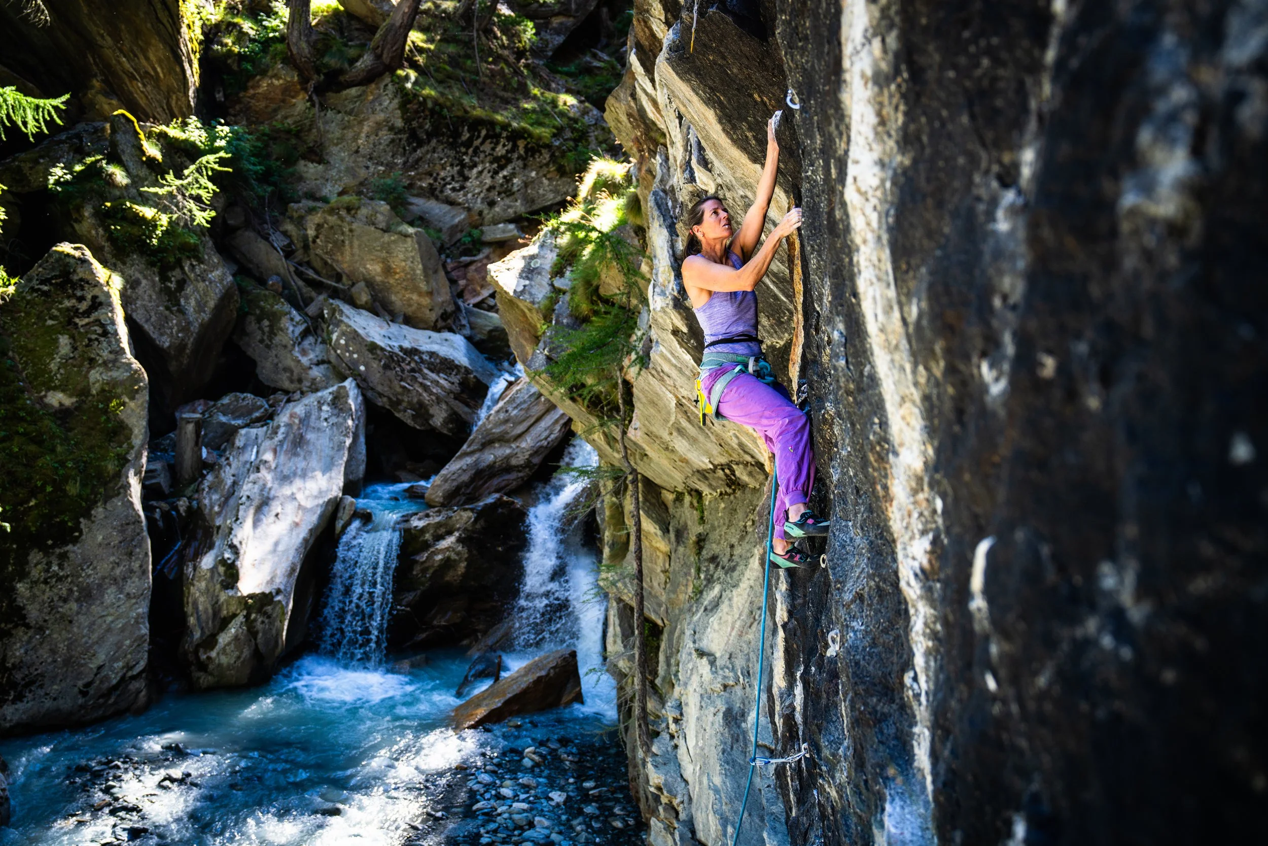
Rock Climbing


Saas-Fee / Saastal Tourism
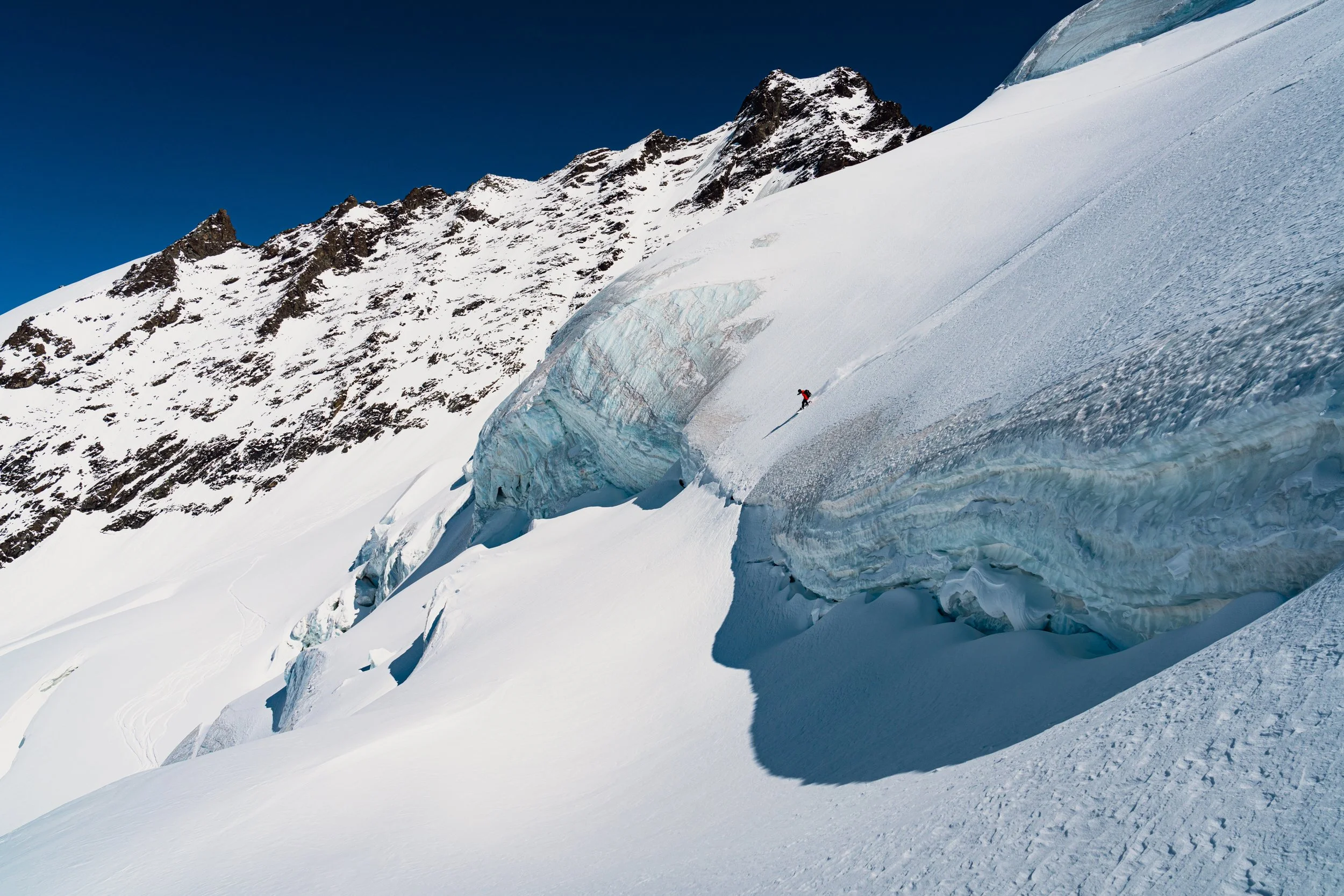
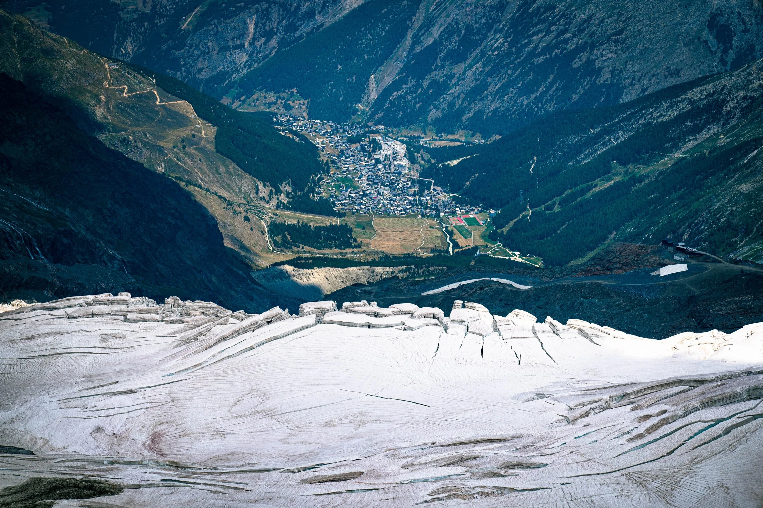
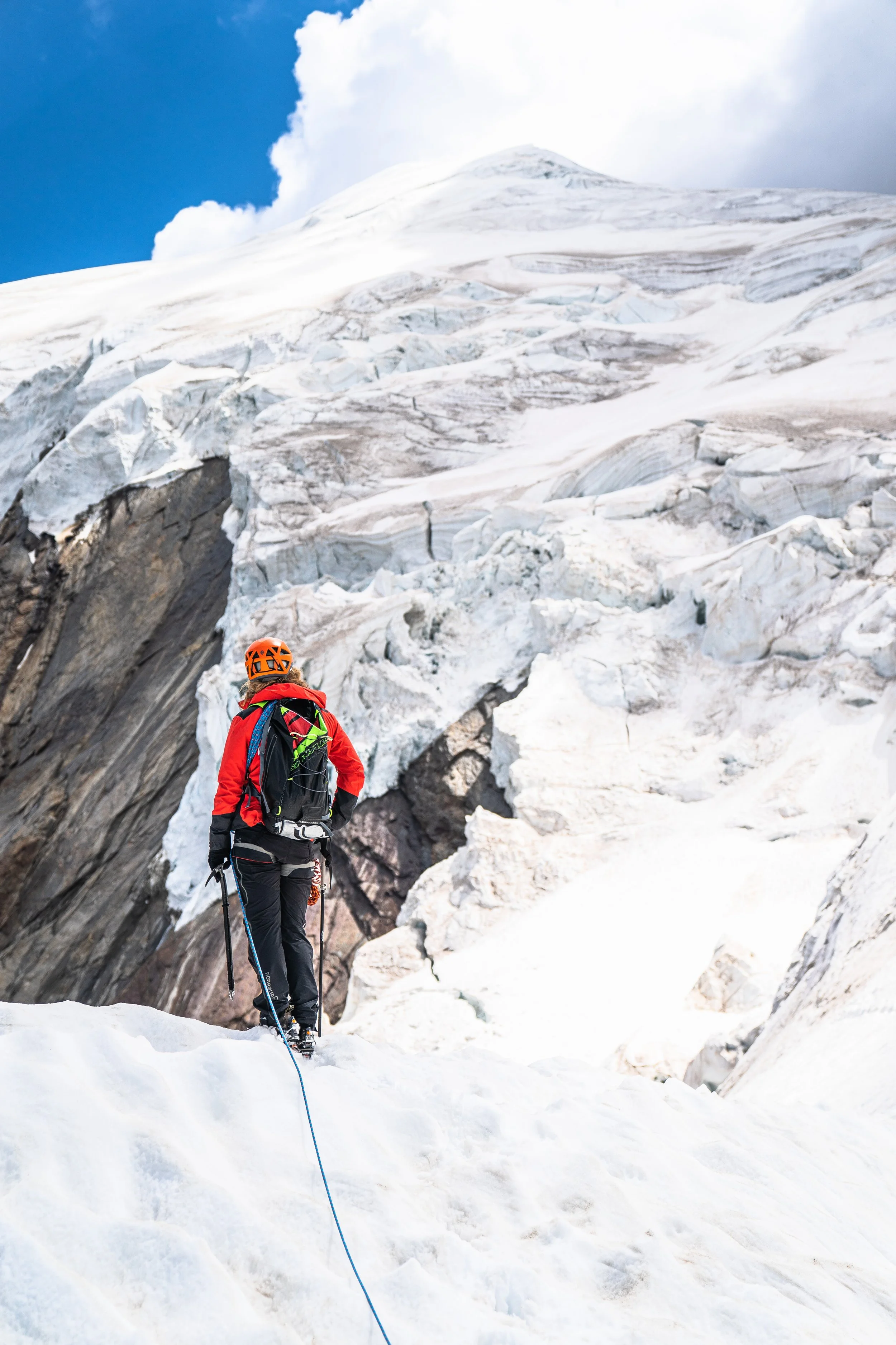
Hunting Seracs
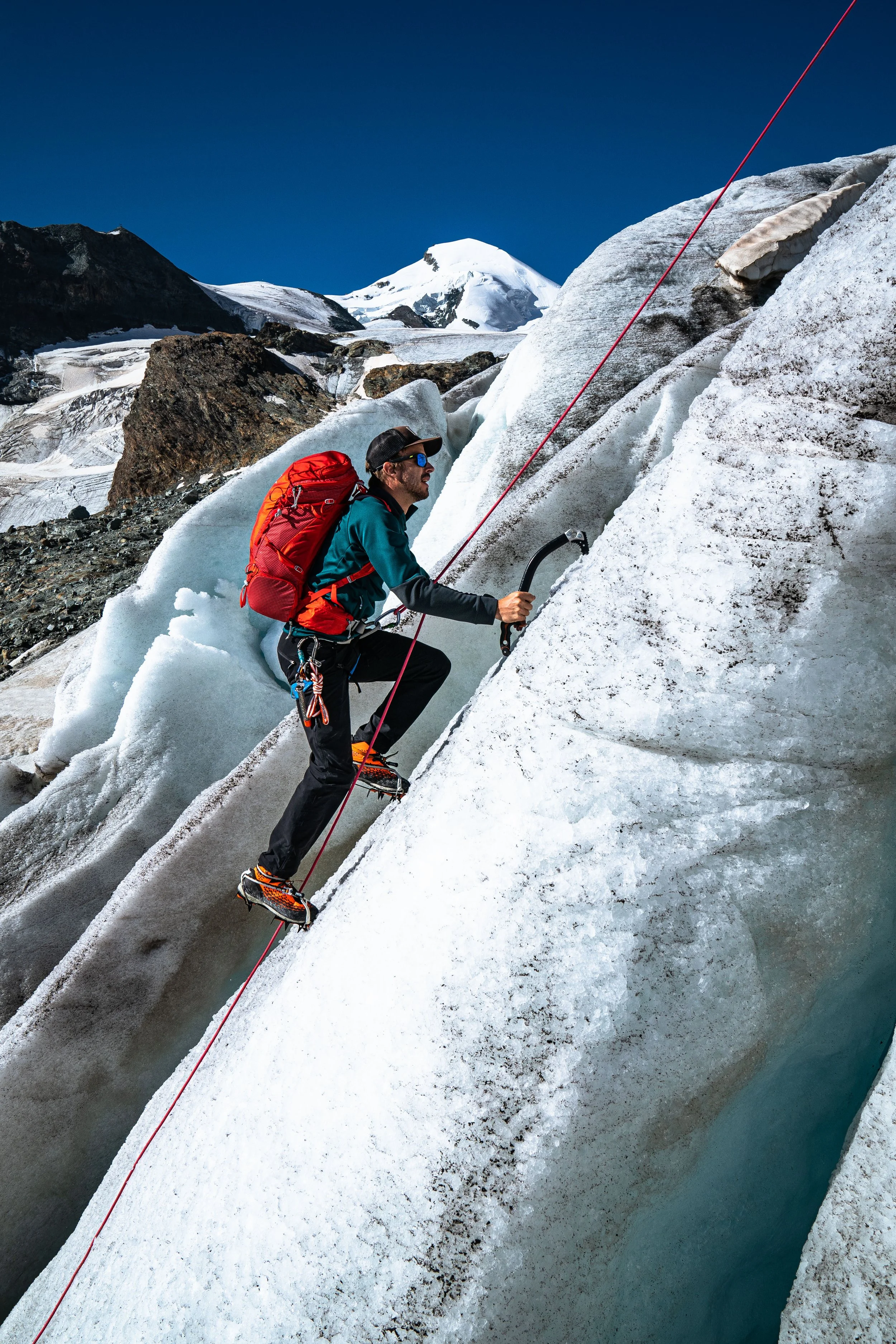

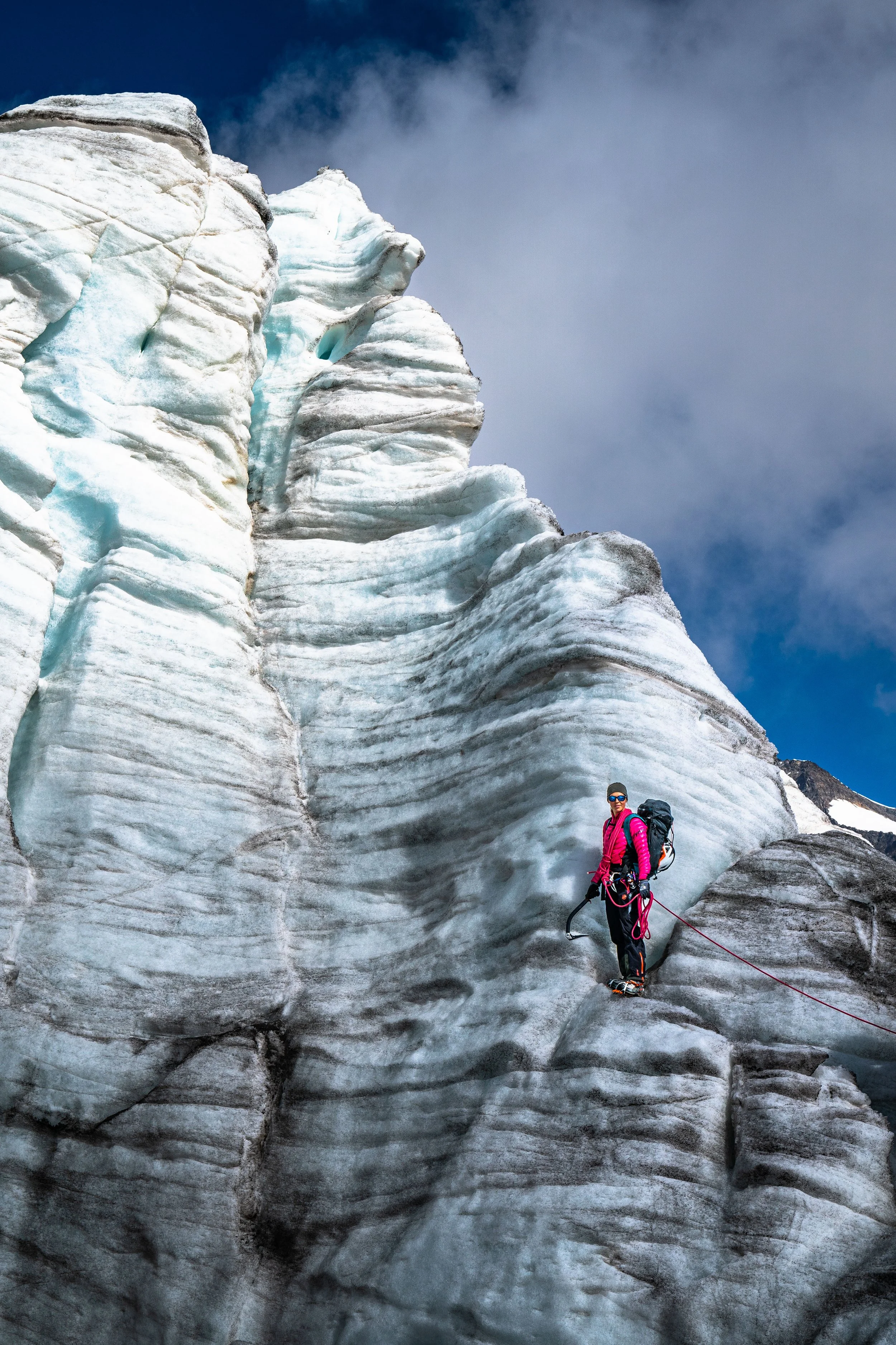


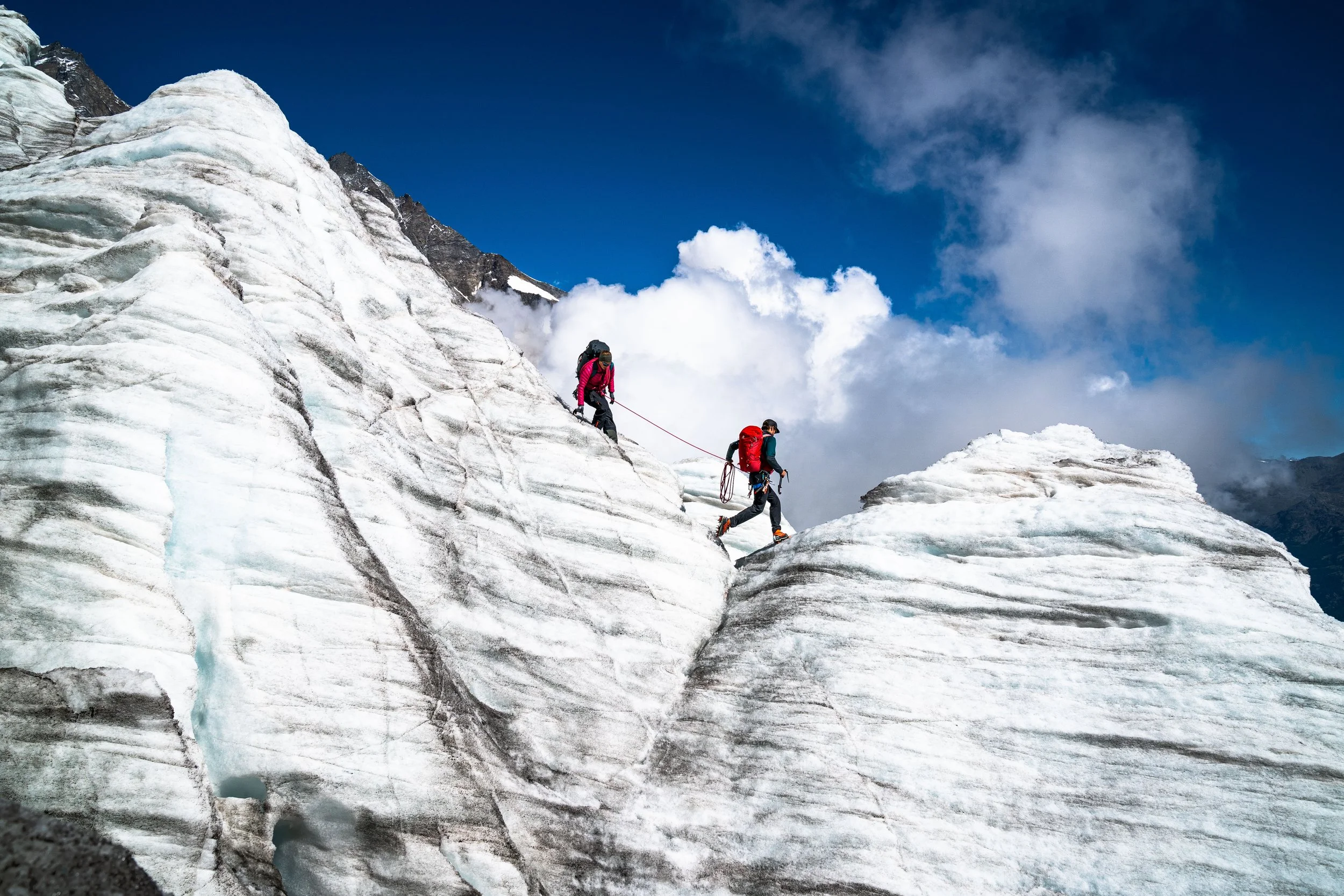
Hunting Seracs
There was a time when a well known slogan for Saas-Fee was „The Glacier Village”. If you look at photos from 100 years ago, the glacier reaches nearly all the way down to the tree line at Felskinn Gondola. Growing up, I can remember being able to see Seracs, blocks or columns of glacial ice as big as a house or hotel, everywhere. 25 years ago, I can remember walking out of the Spielboden gondola and meeting the glacier. At Längfluh, in summer, there used to be massive towers of ice popping up next to the wall.
There used to be a photo shop here in the village called Photo Gilbert. The owner was a photographer and he had all these old photos and postcards printed where he had captured the glacier. To me these were legendary photos of our local history. Every time I walked by his windows I would stop and look. When he closed the shop a few years ago, I bought many of his photos as personal souvenirs. I have one of these photos framed in my house of two mountaineers standing atop a massive serac, with the village visible in the background and it got me thinking about doing my own photo mission in our seracs.
Last year was a terrible winter, and coupled with the high temperatures this summer, the pace of the glacier melting has really quickened. Anyone can see the glacier is suffering, visibly receding in size, shrinking in depth each year. And it was this that motivated me to go on this mission, hunting seracs. I wanted to know, how bad is it really?
My father was a mountain guide, and above my desk at home there hangs a photo of him as a teenager, out on a mission with his father, who was also a mountain guide. My father is standing among the seracs, smiling proudly. I wanted to capture as much of this wonder and beauty as I can while it’s still here. One day they are going to be gone and all we will have left is what we document now.
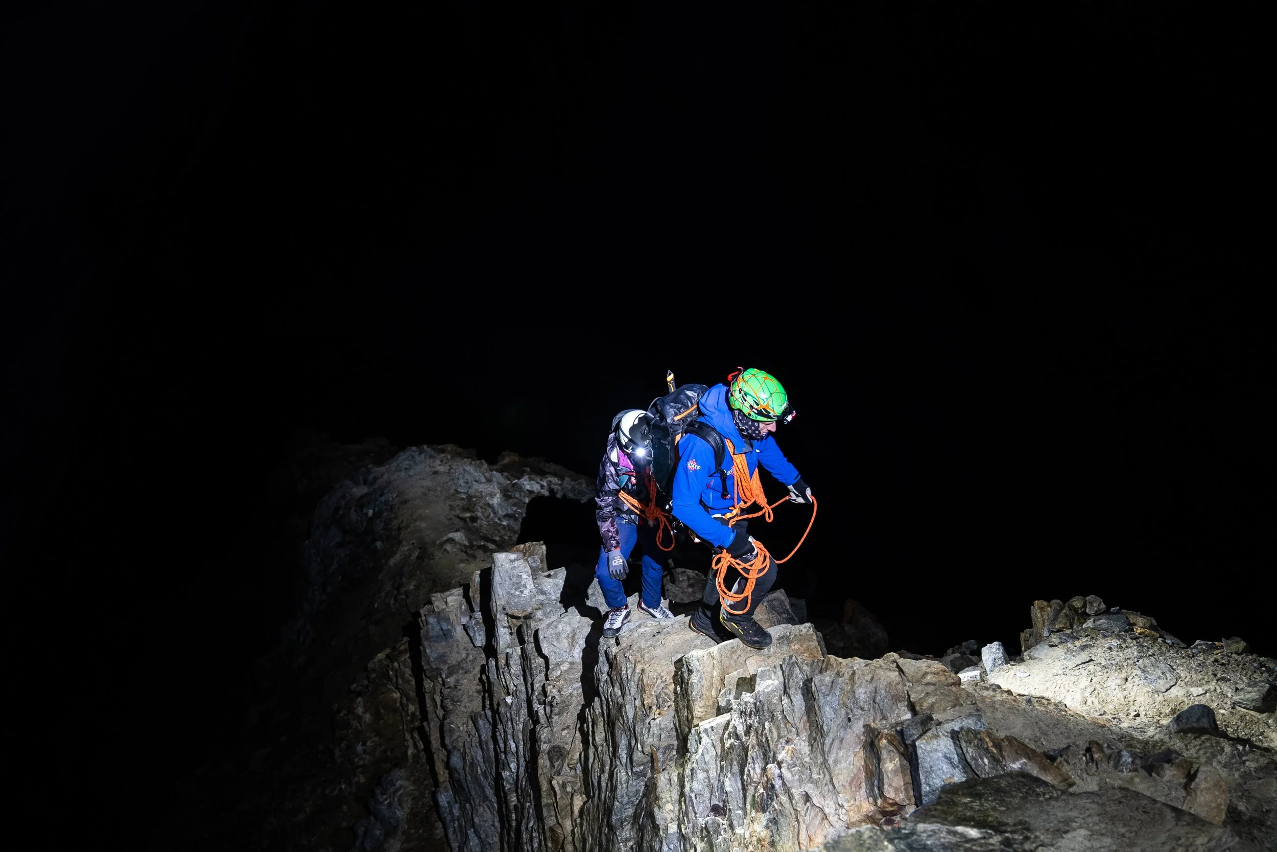
I called up a few mountaineering buddies to see if they would join the hunt with me. Equipped with crampons, ice axes, ropes and harnesses, we set off into the glacier, specifically looking for seracs. The glacier itself is a labyrinth, so you can’t just walk in a straight line. Often seracs are formed by intersecting crevasses. I had some hunches as to where we could find some of these giants, and I was right.
Moving through the glacier toward these huge ice towers showed us indeed how fast the ice is melting. There were rivers flowing right and left. We could also see the brown Sahara dust on the ice. These little specs of sand radiate the heat and accelerate the melting. This sand is nothing new but it’s usually just an annual occurrence. Over the last few years it’s happening more regularly and with more intensity.
But at the same time I was amazed at what we did find – how massive and thick the towers were in places. There are still huge masses of ice. At one point we came to a place where we could only continue by jumping over a crevasse. I’m glad to say that none of us found out how deep it was. And when we did arrive at the seracs, my friends, who are skilled ice climbers, were delighted to do some climbing.
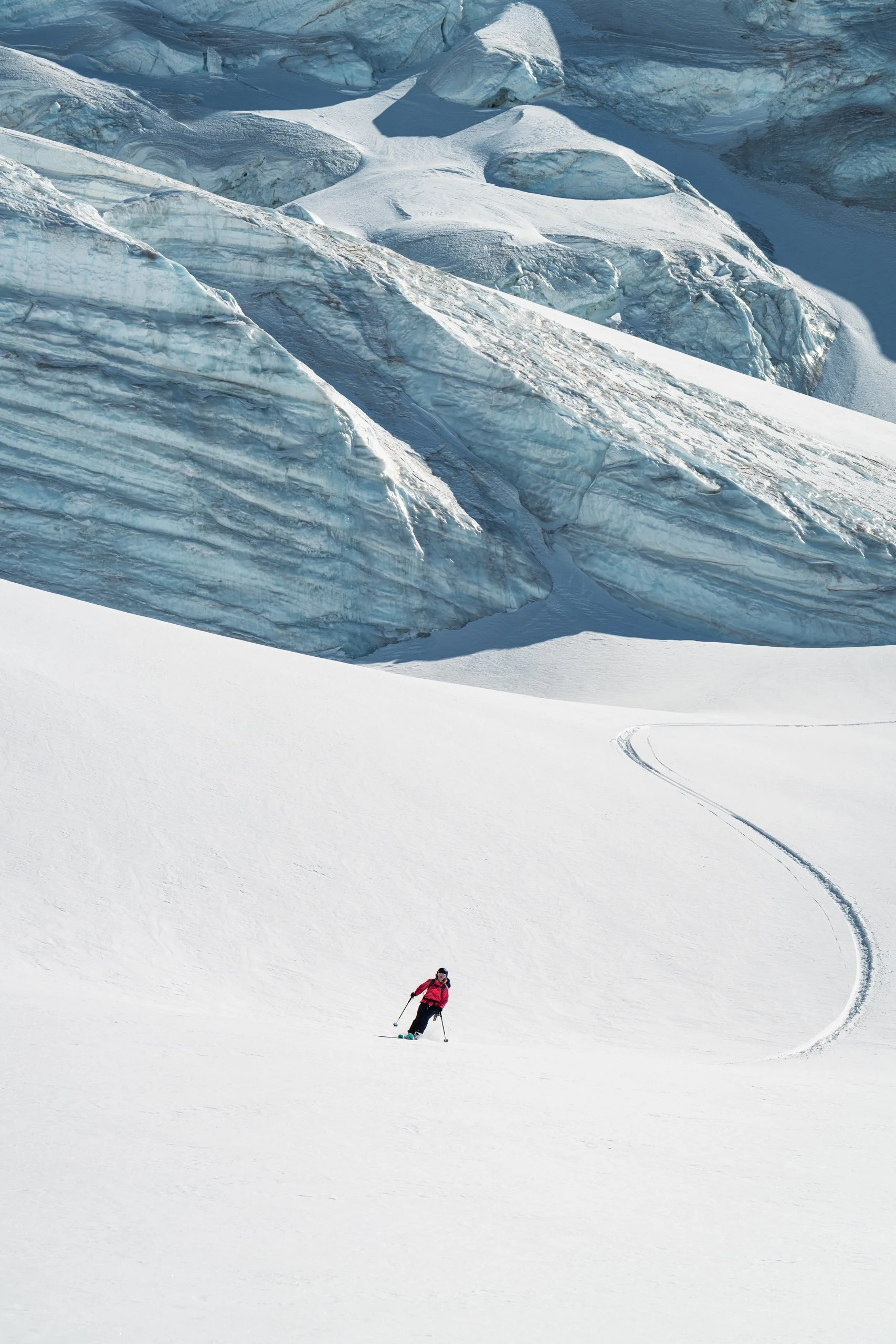
This glacier is a gem, I recommend anyone who is in good shape to hire a guide and go on a tour of this magical place, to see it as long as it still exists. There is nothing like experiencing this magic with your own eyes, it’s like being on another planet. My personal tip is to go in September or October, as this is when they are the most beautiful. The colder temperatures bring out the blues and greens in the ice, but you need to be there before the snow covers them for winter.
I hope for a big snow year next winter, followed by a moderate summer, and I hope for everyone to treat global warming like the crisis that it is and to work together for change.
Saas-Fee / Saastal Tourism
Weissmies - An Indiana Jones Path of the Alps


Weissmies - An Indian Jones Path of the Alps
Weissmies used to be billed as an easy 4,000 m peak, suitable for someone’s second big summit, after climbing Allalin. You could gondola up to Hohsaas, and in a matter of 3.5 hours be at the summit. In 2005 at the 150 year Anniversary of the first ascent of Weissmies, there were 300 people in one day arriving at the summit. But in the last few years, it’s become a much more challenging peak, and that number has plummeted to just a handful a day.
The warming temperatures and the melting of the glacier have resulted in more crevasses and a danger of falling ice. The normal route was even closed at the beginning of this year as it was deemed too dangerous. Then the Saas-Grund Gemeinde approved a route change to avoid the fall line of potential breaking ice.
I spoke with several of our local guides about the normal route before going up this time. One told me he doesn’t take clients on the normal route anymore, another said he would only do it with a client that he knew well and whose abilities he had confidence in. Yet another told me the new challenges make it more fun, now it’s quite an adventurous route to the summit.
Besides the normal route, there are 3 other routes to the Weissmies summit, each of varying difficulties. I had done all of the routes except for the Rotgrat, and I always wanted to do this route as it’s the ridgeline you see from the village. It’s the view I see every day from my living room. It didn’t used to be very popular, but since the normal route has become so much more challenging, more people are moving to the Rotgrat. It’s also not as technical as the Nordgrat and you can make a loop of it down the Südgrat or start from the Almageller Hütte.
But that’s not what I was looking for. I was in need of some training, as I was hoping to do the Mischabel traverse a few days later. So instead of spending the night in the Almageller Hütte or starting with a gondola ride to Hohsaas, I started from my house, planning to ascend the Rotgrat and descend the Normal route.
I left my house at 2:45 am and biked down to Saas-Almagell in the semidarkness. The moon was full, but in the trees along the road to Bodmen it was quite dark. I saw a flying object heading towards me and at the last second I turned my head away, only to have a bat crash into the side of my helmet. What a second cup of coffee!
At 3 am I met my buddy in Saas Almagell and we started up to the Almageller hut. The moon had set and it was a bit cloudy, but we did some speed walking in the darkness, encountering lots of animals, including a lynx and the usual suspects, the steinbock. At dawn we passed the hut, making our first stop at a small lake that perfectly framed Allalinhorn in the early light.
A few years ago, they repainted all the trail markers, so you really can’t get lost. This is also really important for those cases when the weather rapidly changes and you have less visibility. The Rodgrat offers great views over the Saas Valley, the trail is not very technical, and it is easy to scamper along if you are in good shape. There are also some fun mountaineering climbing sections.
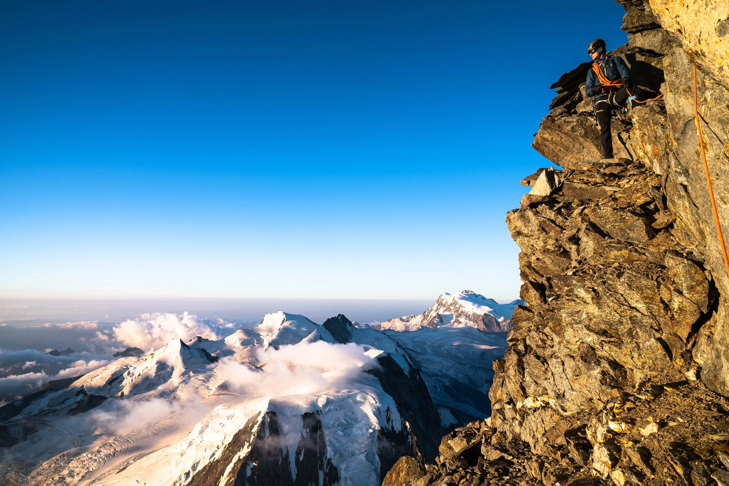
We ascended the ridgeline all the way to the glacier, where we donned our crampons and got on the rope. At this point the clouds were hovering right over the summit. There were a bit of hide and seek clouds, coming in and out all the time, so we felt comfortable enough to continue. When we did summit, after 7 hrs 20 minutes, including breaks for snacks and photos, it was a bit anticlimactic. There is no cross on the summit, just a stake with some Tibetan prayer flags. The weather didn’t live up to what was forecast, so it wasn’t possible to get any nice photos.
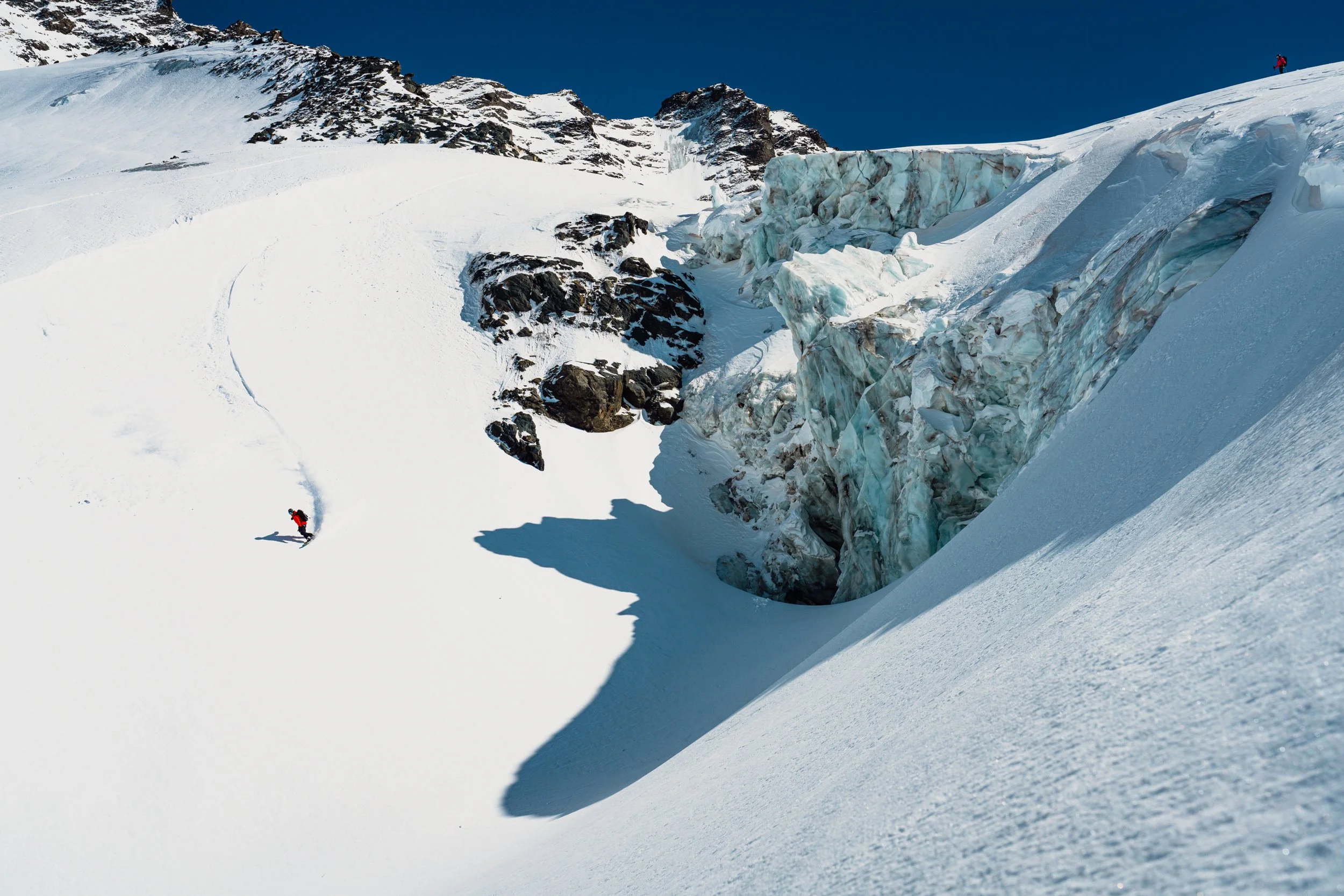
But for me, the best part of the whole adventure was still ahead, the challenging descent down the normal route to Hohsaas. Standing at the summit looking down, we could see the vast difference from what the route was 5 years ago, and it’s current state. It was not going to be a straight shot, and nothing like the highway up to Allalin that it used to be comparable to.
There was an obvious need to be cautious among so many risk factors. This was such a warm summer. All around us the snow was slushy with crevasses right and left. The trail had been closed for some weeks, and even though it was open now, no one was on it because of the looming dangers.
From the summit, I made a quick call to my brother in law, Andi, a local guide. He gave me an update on the normal route from a fellow guide that had done it 3 days earlier. Andi encouraged me to descend this way, saying the worst thing that can happen is we have to make the call to turn around and go home the long way.
And so we began to descend through the labyrinthine. It was, no joke, an Indiana Jones style path to avoid doom in the form of huge seracs, massive crevasses, and step icy sections that had to be crossed. Slowly and carefully, we navigated this maze, hyper alert for any break in the ice, anything that might come crashing down around us. I snapped a photo at the little lake just above the top of Hohsaas and looking up at the glacier above it seems crazy that we just passed through there. You can’t really pick out the route at all. After a 12 hour day, I came home happily expended, tired but feeling that full body high from the adventure.
Depending on your vantage point, Weissmies looks like there isn’t much ice left. It’s hard to tell if the glacier even connects top to bottom any more. Looking at the amount of water pouring out in summer, watching the glacier melt yearly, it seems obvious that very soon there will be no more glacier. But once we were in there, we experienced the north facing section to still be loaded with ice. It was a similar experience to when I went hunting seracs a few weeks before. The glacier still holds a meaty chunk of ice, it’s not dead yet. If your health allows it, I really encourage you to hire a guide and go see the glacier before it’s gone.
Saas-Fee / Saastal Tourism
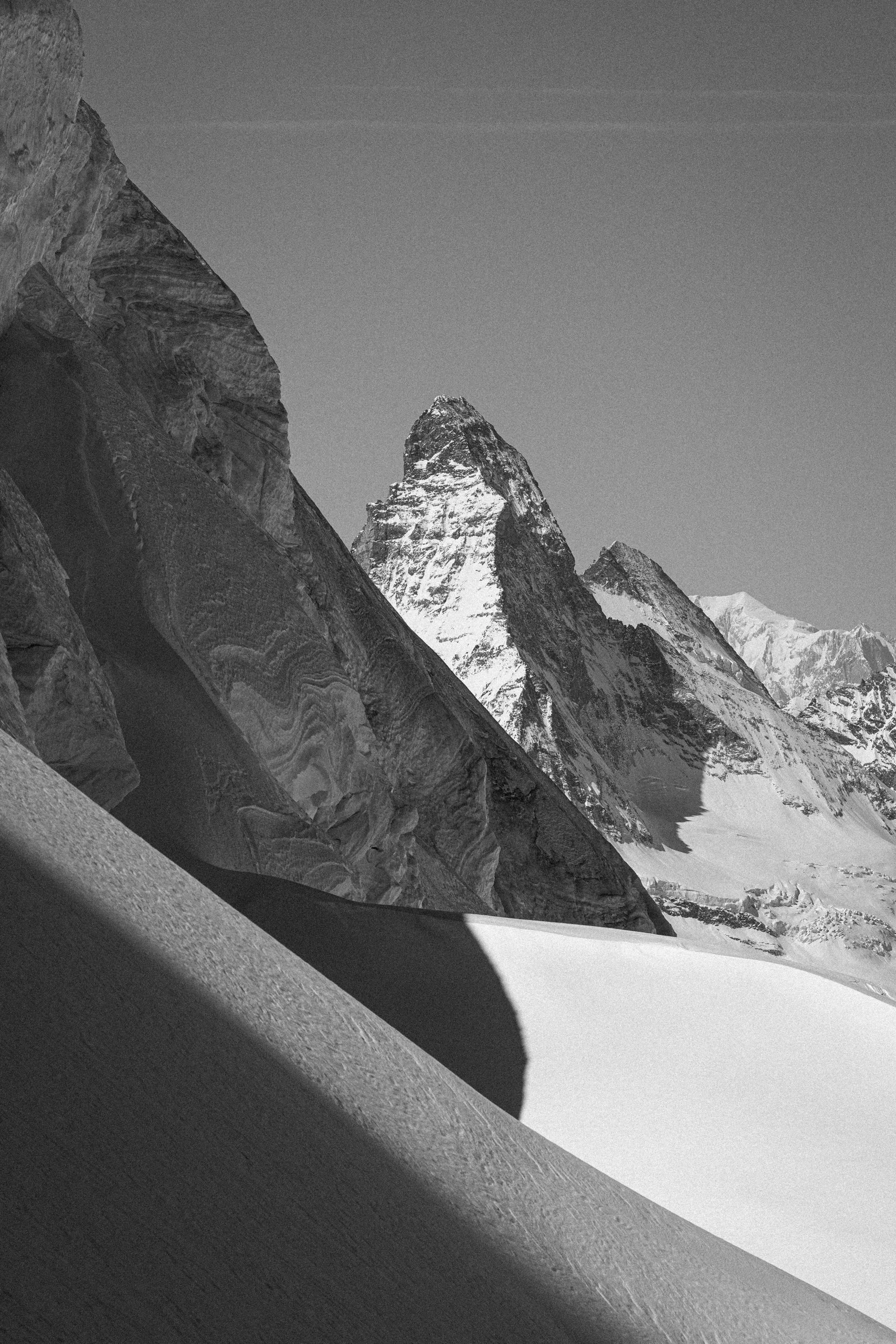
The Rimpfischorn